Complete NCERT Solutions Guide
Access step-by-step solutions for all NCERT textbook questions

Welcome to the Chapter 4 - Maps, Class 6 Social Science - The Earth Our Habitat NCERT Solutions page. Here, we provide detailed question answers for Chapter 4 - Maps. The page is designed to help students gain a thorough understanding of the concepts related to natural resources, their classification, and sustainable development.
Our solutions explain each answer in a simple and comprehensive way, making it easier for students to grasp key topics Maps and excel in their exams. By going through these Maps question answers, you can strengthen your foundation and improve your performance in Class 6 Social Science - The Earth Our Habitat. Whether you’re revising or preparing for tests, this chapter-wise guide will serve as an invaluable resource.
(a) The three components of the maps are:
(b) The four cardinal directions are: North, South, East and West.
(c) Scale is the ratio between the actual distance on the ground and the distance shown on the map.
(d) Maps are more helpful than a globe in the following ways:
(e) Maps: A map is a representation or a drawing of the Earth’s surface or a part of it drawn on a flat surface according to a scale.
Plan: It is a drawing of a small area on a large scale.
(f) Large scale maps give more information than small scale maps, as they cover more space on the map to show features. And, they are easy to study or know than the small scale ones.
(g) Different signs we use to detect a place on a map are called symbols.
(a) (ii) Thematic map
These are the maps which focuses on the specific information like rainfall maps, maps showing distribution of forests etc.
(b) (i) Water bodies.
Different water bodies like river, well, canals or bridges are represented mostly by blue colour.
(c) (ii) To find the main direction
A compass is used to find the cardinal points (North, South, East, West) and the other intermediate directions (North east, North west, South east, South west).
(d) (i) Map
Maps are classified into two types: Small scale map and Large scale map. Scales are used to measure the actual distance on the ground and the distance shown on the map.
Stay updated with our latest educational content and study tips

Interest is one of the most significant ideas in maths and financial calculations. It is very common in banking, loan applications, investments, saving account and competitive exams. Simple Interest and Compound Interest make it easier to find out how much more is earned and/or paid on a principal during the period of time. These Interest … Read more
Read More
In 2026, students, professionals, and job seekers must have a high level of spoken English. Spoken English is a beginner level course to enhance learners’ communication skills in English, their pronunciation, vocabulary, grammar structure and confidence in speaking English fluently. Today, the emphasis of spoken English courses is placed on actual conversations, everyday speech practice … Read more
Read More
Artificial Intelligence (AI) and Machine Learning (ML) are two of the most sought-after technologies in today’s digital era. Although these terms are often used together, they are not the same. Machine Learning is, in fact, a component of Artificial Intelligence that enables systems to learn and enhance on their own, without direct programming. AI is … Read more
Read More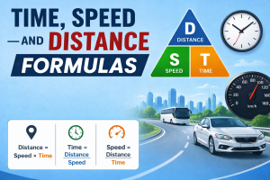
Time, Speed, and Distance are some of the most important concepts in mathematics and aptitude. These are the concepts which are used to calculate the speed of an object, time taken for an object to move and the distance traveled during the motion. Questions from this topic are frequently seen in School Tests, Competitive Tests, … Read more
Read MoreExplore more educational resources to enhance your learning journey

Access step-by-step solutions for all NCERT textbook questions

Practice with latest CBSE sample papers for all classes

Quick reference guide for all important mathematical formulas

Complete multiplication tables with tips and tricks

Discover proven study methods that help students excel in board examinations.

Complete guide to career options and decision-making after completing Class 12.

Learn scientific methods to improve memory and retention for better academic performance.
Join thousands of students who have improved their academic performance with our comprehensive study resources.